Precision in Every Detail

Advanced visualization and surveying solutions driving infrastructure success

Rated 5 Stars

★★★★★

Precision Meets Innovation

At Dessin Solutions, we deliver advanced visualization and surveying technologies tailored for infrastructure and construction projects.

low angle photography curtain wall buildings
Drone capturing aerial survey data over a large construction site under clear skies.
Close-up of a technical team analyzing BIM models on multiple screens in a modern office.

Our Commitment

We combine precision engineering with cutting-edge technology to support EPC contractors and government projects worldwide.

Our Services

Precision-driven solutions tailored for infrastructure and construction projects.

3D & VR

Immersive walkthroughs that bring projects to life.
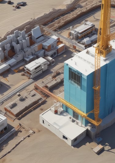
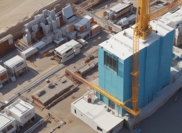
A detailed 3D rendering of a modern bridge with VR headset overlay.
Drone Survey

Accurate aerial mapping & progress monitoring from above.

A drone flying over a large construction site capturing topographic data.
BIM Technology
Miniature Models
A detailed 3D rendering of a modern bridge with VR headset overlay.
white concrete building during daytime

3D/4D/5D BIM, clash detection, planning, cost optimization

Architectural precision physical models for presentations

Technical Films

Project documentation and progress films

black nikon dslr camera on white printer paper

Industries Served

Showcasing precision in infrastructure visualization.

A detailed 3D infrastructure model highlighting complex urban planning.
Infrastructure

Advanced mapping for bridges and roads.

Drone capturing aerial survey data over a large construction site.
Real Estate

Accurate surveys of commercial sites.

Close-up of a high-precision architectural miniature model on display.
Engineers reviewing BIM models on multiple screens in a modern office.
Government

Detailed documentation for public projects.

Consultancy

Expert insights for project planning.